
Satellite imagery and field reports indicate a “checkerboard” frontline as Ukrainian marines expand footholds and Russian airborne units shift to localized counter-infiltration.
Publication date: May 6, 2026
Last updated: May 6, 2026
By Staff Writer, Global War News
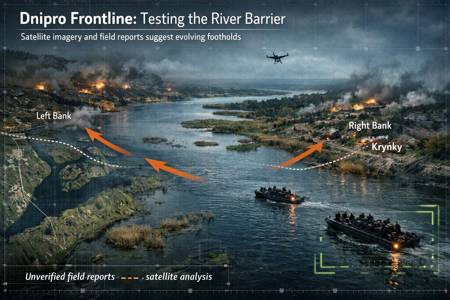
The southern front along the Dnipro River has entered a phase of high-intensity amphibious maneuvering. Following months of static artillery duels, recent reporting from the Ukrainian 34th Separate Marine Brigade and geolocated satellite imagery suggest that Ukrainian forces have successfully expanded several tactical footholds on the Russian-controlled left bank, specifically within the marshy dacha districts near the Antonivskyi Bridge.
According to verified footage published by Ukrainian marine units on May 3, specialized amphibious teams captured several Russian paratroopers from the 98th Guards Airborne Division during a contested crossing near the Konka River. These developments coincide with a broader slowdown in the Russian rate of advance across the theater, which the Institute for the Study of War (ISW) reports has reached its lowest net gain since 2024.
Shifting Frontlines: The “Dacha” Foothold
The current frontline along the Dnipro is no longer a single, continuous line but a series of isolated “islands” and fortified positions. Satellite imagery analyzed by independent researchers on May 5 shows new Ukrainian defensive earthworks and drone-launching platforms established in the vicinity of the Oleshky sands.
While the Russian Ministry of Defence (MoD) has not officially confirmed any loss of territory in the Kherson sector, unverified reports from Russian military bloggers suggest a tactical withdrawal of some forward observation posts. One prominent blogger noted that Russian paratroopers were ordered to conduct “shovel-only” assaults in certain marshy sectors after losing heavy equipment to Ukrainian first-person view (FPV) drones during the crossing of river channels.
Tactical Evolution: Infiltration and Drone Dominance
The character of the river war has shifted toward “infiltration tactics,” a term used by analysts to describe small-unit actions that do not initially change the visible control of terrain on a map but undermine the defender’s stability.
- Ukrainian Amphibious Training: The reorganization of the 30th Marine Corps in March 2026 into specialized separate marine brigades has reportedly increased Ukraine’s capacity for ship-to-shore and helicopter-borne landings.
- Russian Defensive Adaptations: In response to Ukrainian footholds, Russian forces have reportedly increased their use of glide bombs and “Molniya” drones. However, ISW notes that Russian “Victory Day” ceasefire plans (set for May 8-9) may temporarily stall these counter-operations, potentially allowing Ukrainian forces to further fortify their left-bank positions.
Analysis: What This Could Mean
The strategic goal of these amphibious operations is likely the creation of a “buffer zone” that prevents Russian tube artillery from reaching Kherson City, while simultaneously forcing Russia to redeploy reserves from the active Donbas and Sumy fronts.
For the first time in 2026, the net gain of territory appears to be shifting in favor of localized Ukrainian counter-offensives. If Ukrainian marines can secure a stable supply route across the Dnipro for armored vehicles, beyond the current small-boat logistics, it would represent a significant threat to the Russian “land bridge” to Crimea. However, observers warn that the swampy terrain of the Dnipro delta remains a natural bottleneck, where any large-scale movement is easily detected by Russian reconnaissance drones operating 30 to 70 kilometers from the frontline.
Outlook
The stability of the Russian “Western Group of Forces” in the south is currently being tested by these high-mobility marine incursions. The coming weeks will be decisive in determining whether the Ukrainian footholds are sustainable “lodgments” or merely temporary distraction points designed to fix Russian airborne units in place before the summer 2026 campaign season begins in earnest.
Source Disclosure Note: This report is based on geolocated video evidence from the Ukrainian 34th Separate Marine Brigade, operational assessments from the Institute for the Study of War (ISW), satellite imagery analysis, and attributed reports from the National News Agency of Ukraine and Russian state media.
This article is based on publicly available reporting from named international news agencies and attributed official statements. All claims about ongoing events are attributed to their original sources. Analysis sections represent the editorial interpretation of reported facts and do not constitute advocacy for any party to the described conflict. AI tools may be utilized for image generation to assist in explaining complex concepts, as well as for refining grammar, spelling, and other linguistic enhancements. However, all original content is produced, fact-checked, and revised by the editorial team. This publication does not take political positions on active military conflicts.