
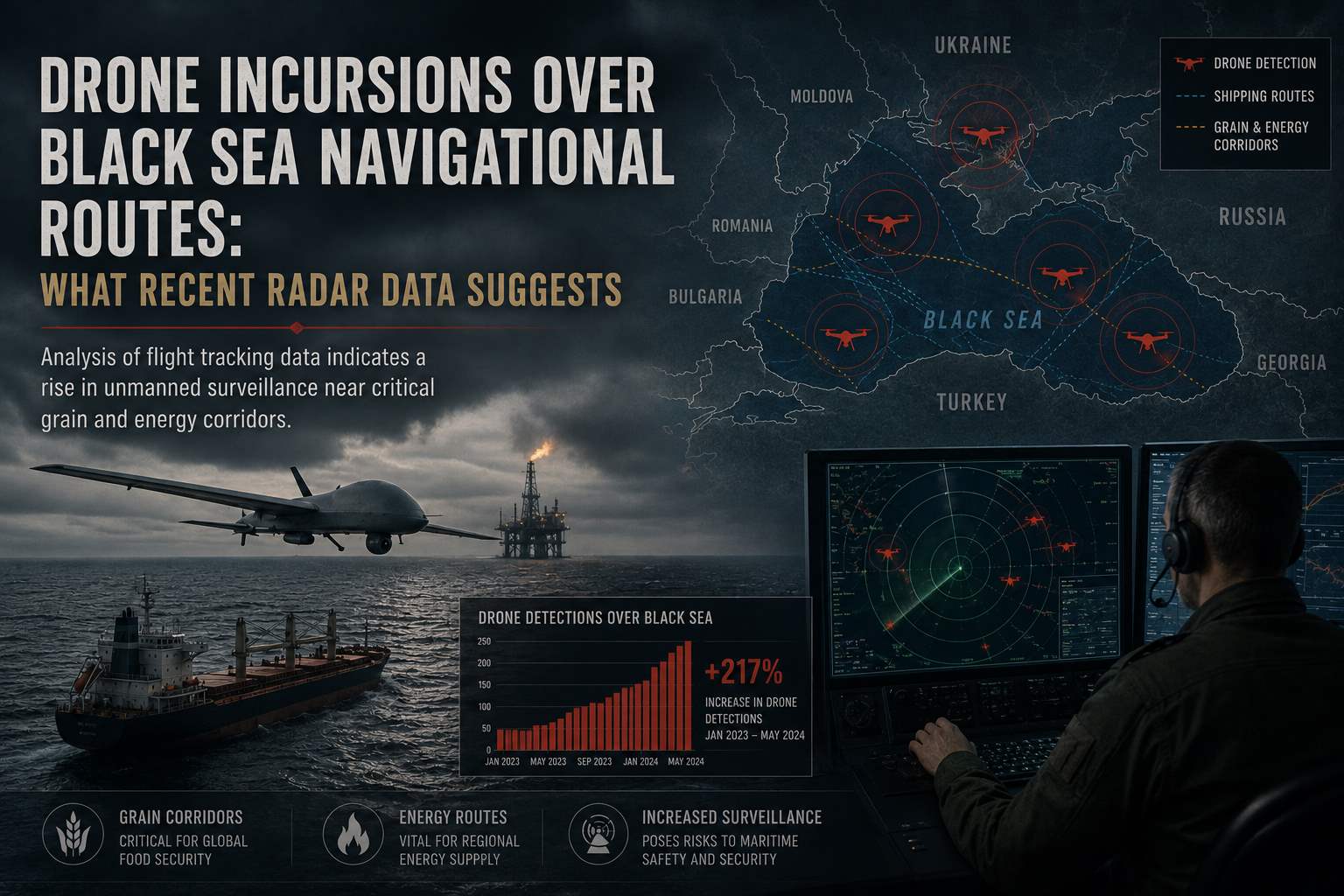
Analysis of flight tracking data indicates a rise in unmanned surveillance near critical grain and energy corridors.
May 7, 2026
Last updated: May 7, 2026
By Global War News Editorial
Recent radar and flight tracking data have identified an increase in unmanned aerial vehicle (UAV) activity over established maritime corridors in the Black Sea. These incursions, occurring primarily near neutral navigational routes used for the transit of grain and fuel, have raised concerns regarding the safety of commercial shipping in international waters.
According to data analyzed by the Maritime Security Center, several unidentified drones were tracked operating at low altitudes within 20 nautical miles of the main shipping lanes connecting the Bosporus Strait to northern ports. While no kinetic engagements were reported overnight, the presence of these assets suggests a shift toward persistent, close-range surveillance of commercial traffic.
Mapping the Surveillance Patterns
The Black Sea has remained a highly monitored zone since the escalation of regional hostilities in 2022. However, the nature of recent incursions differs from previous patterns. Traditionally, high-altitude surveillance was conducted by strategic assets. Recent reports from Reuters indicate a surge in smaller, tactical drones that are more difficult for standard civilian radar to detect.
Independent monitors from the Black Sea Grain Initiative’s successor framework noted that these drones often operate with transponders turned off, making them “invisible” to the Automatic Identification System (AIS) used by cargo vessels. This creates a risk of mid-air collisions with search-and-rescue helicopters or low-flying maritime patrol aircraft.
Impact on Insurance and Maritime Logistics
The tactical presence of drones directly correlates with the economic stability of regional trade. According to a briefing from Lloyd’s of London, war risk insurance premiums for vessels traversing the western Black Sea have remained volatile, with a 5% increase noted following reports of “unidentified aerial interference” near the Danube delta.
In a statement, the International Maritime Organization (IMO) emphasized that while freedom of navigation in international waters must be respected, the “uncoordinated use of UAVs” in proximity to commercial vessels poses a significant safety hazard. The IMO has called for better communication between military command centers and civilian port authorities to prevent accidental escalations.
Analysis: Surveillance vs. Interdiction
The primary question for observers is whether these drone incursions are limited to intelligence gathering or if they represent the precursor to active interdiction. By maintaining a constant presence over navigational routes, involved parties can monitor the “sanctions compliance” of various vessels in real-time.
However, this constant “shadowing” of commercial ships also serves as a form of psychological pressure. Analysts at the Center for Global Strategic Studies suggest that the goal may be to create a “deterrence by uncertainty,” where the mere possibility of a drone strike or electronic jamming discourages shipping companies from using certain routes, effectively closing them without the need for a formal naval blockade.
What to Watch
In the coming weeks, maritime authorities will be watching for the deployment of ship-borne electronic counter-measures (ECM) on civilian tankers. If commercial fleets begin to adopt military-grade jamming technology to protect against these drones, it would signal a significant escalation in the “militarization” of global trade routes. Additionally, a scheduled meeting of the Black Sea Littoral States in June is expected to address new protocols for UAV identification in shared airspace.
Sources: Maritime Security Center (MSC) radar analysis, Reuters maritime reporting, International Maritime Organization (IMO) public statement, Lloyd’s of London market briefing, Center for Global Strategic Studies (CGSS).
This article is based on publicly available reporting from named international news agencies and attributed official statements. All claims about ongoing events are attributed to their original sources. Analysis sections represent the editorial interpretation of reported facts and do not constitute advocacy for any party to the described conflict. AI tools may be utilized for image generation to assist in explaining complex concepts, as well as for refining grammar, spelling, and other linguistic enhancements. However, all original content is produced, fact-checked, and revised by the editorial team. This publication does not take political positions on active military conflicts.