
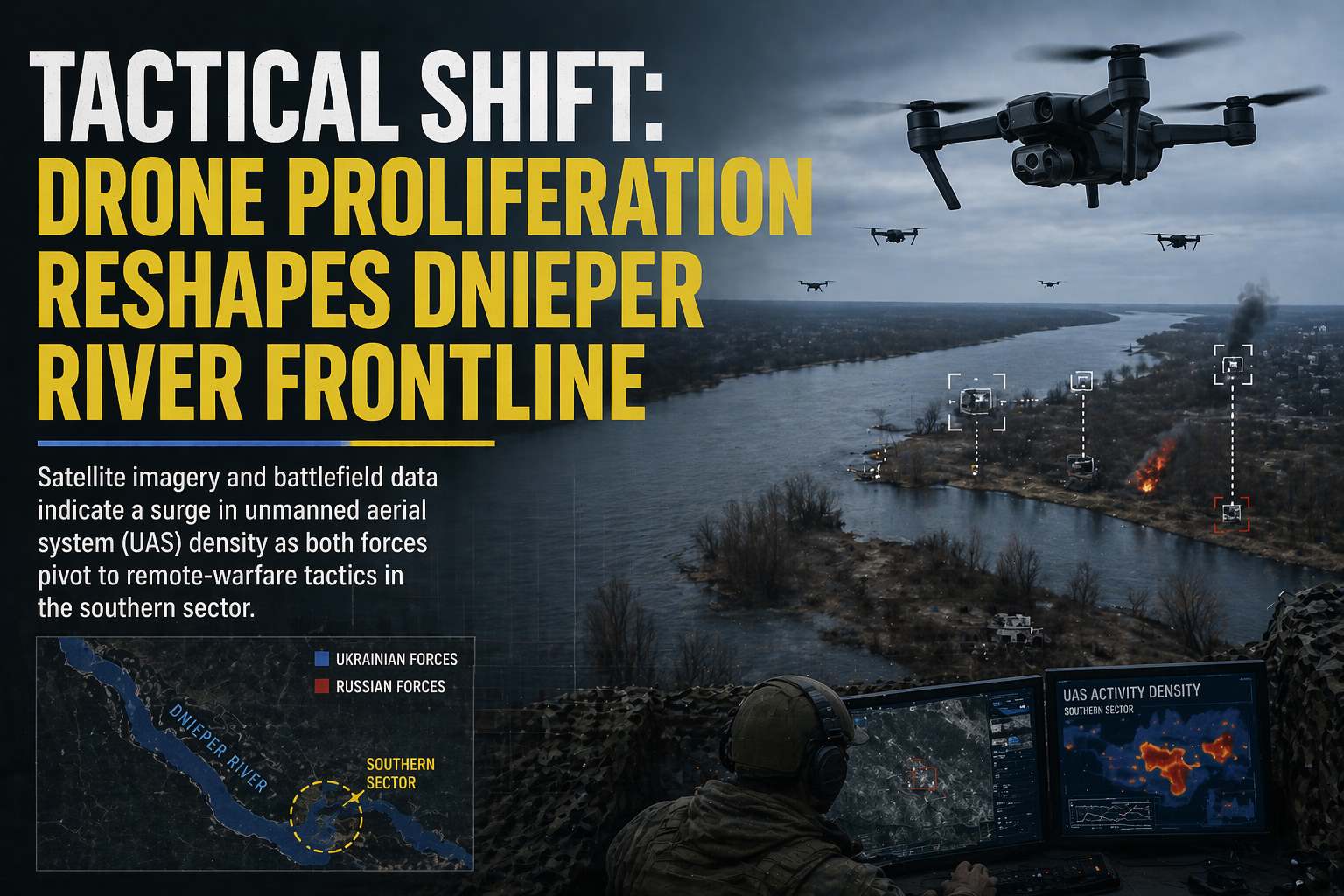
Satellite imagery and battlefield data indicate a surge in unmanned aerial system (UAS) density as both forces pivot to remote-warfare tactics in the southern sector.
April 21, 2026
By Global War News Editorial
The Dnieper River, a critical geographic barrier and strategic artery in Southern Ukraine, has become the center of a significant tactical evolution in drone deployment. According to recent satellite imagery analysis and verified frontline reports from independent research institutions, including the Institute for the Study of War (ISW), both Ukrainian and Russian forces have drastically increased the density of unmanned systems along the river’s banks.
This shift follows a winter of relative stagnation and marks a pivot toward what analysts describe as “Drone Line” operations, systematic, tiered echelons of reconnaissance and strike drones designed to paralyze enemy movement within a 10-kilometer radius of the forward line. The current density of these systems has reportedly rendered traditional motorized maneuvers increasingly difficult in the open terrain surrounding the river.
The “Drone Line” Strategy
According to analysis by the Foreign Policy Research Institute, the Russian military has been experimenting with a “Drone Line” organizational structure. This concept task-organizes strike units into two distinct echelons:
- First Echelon (0–5 km): Focused on immediate battlefield interdiction. These units utilize First-Person View (FPV) drones to target individual personnel, light vehicles, and established trench positions.
- Second Echelon (5–25 km): Specialized units, including those from separate spetsnaz brigades, target higher-value assets such as artillery systems, electronic warfare (EW) repeaters, and logistics hubs.
Satellite imagery published on April 20 confirms that this tactical depth is mirrored by Ukrainian forces, who have reportedly achieved a notable drone advantage in the Kherson sector. According to Ukrainian General Staff briefings, their Unmanned Systems Forces (USF) are now performing over 11,000 combat missions per day across all fronts, with a high concentration directed at disrupting Russian river crossings and logistics in occupied territory.
Technological Adaptations on the Water
The Dnieper’s unique geography—comprising marshlands, islands, and wide open water—has forced specific technological adaptations. Analysts note that Ukrainian forces recently utilized drones to destroy a Russian-controlled bridge in occupied Kherson Oblast, marking one of the first documented cases of a bridge being neutralized exclusively via unmanned aerial strikes.
Independent researchers have also observed the deployment of fiber-optic-guided drones by Russian units. These “tethered” systems are reportedly immune to standard electronic warfare jamming, allowing them to maintain connectivity in the high-interference environment of the Dnieper’s delta.
Economic and Industrial Impact
The scaling of drone warfare along the Dnieper is the result of a massive industrial pivot. Ukraine has stated its intention to produce approximately 8 million drones in 2026, a fourfold increase from 2024 levels. This decentralization of production—relying on a network of small startups and volunteer groups—has created a “just-in-time” supply chain for the front.
Conversely, Russian drone production has faced localized disruptions. On April 19, Ukrainian Neptune cruise missiles reportedly struck the Atlant Aero drone production facility in Taganrog. Satellite imagery reviewed by Radio Svoboda confirmed significant damage to workshops involved in manufacturing the Molniya-series loitering munitions, potentially impacting the supply of reconnaissance drones to the Southern axis in the short term.
Analysis: The End of Maneuver?
The saturation of drones along the Dnieper raises questions about the future of ground maneuvers in the region. Observers note that when roughly 80–85% of frontline targets are engaged by drones, the “transparency” of the battlefield becomes absolute. Any movement—whether a motorized platoon or a single logistics truck—is detected and targeted within minutes.
This raises the prospect of a prolonged stalemate where territorial gains are measured in meters and achieved only through the systematic degradation of enemy drone networks. It remains unclear whether either side can develop effective counters to this “automated” defense before the arrival of summer foliage provides additional natural concealment.
Closing Summary
As of April 21, the Dnieper River remains a high-risk zone for any conventional military movement. The “Drone Line” experiments currently being conducted by both forces suggest that the southern front is transitioning into a war of technical attrition. We are continuing to monitor satellite data and official bulletins for any shifts in drone-to-artillery ratios as the spring campaign progresses.
Sources:
This report is based on analysis from the Institute for the Study of War (ISW), the Foreign Policy Research Institute (FPRI), and satellite imagery reviewed by Radio Svoboda and Planet Labs. Tactical data was cross-referenced with official briefings from the Ukrainian General Staff and the Russian Ministry of Defence.
This article is based on publicly available reporting from named international news agencies and attributed official statements. All claims about ongoing events are attributed to their original sources. Analysis sections represent the editorial interpretation of reported facts and do not constitute advocacy for any party to the described conflict. AI tools may be utilized for image generation to assist in explaining complex concepts, as well as for refining grammar, spelling, and other linguistic enhancements. However, all original content is produced, fact-checked, and revised by the editorial team. This publication does not take political positions on active military conflicts.